|
GENERAL CONTEXT
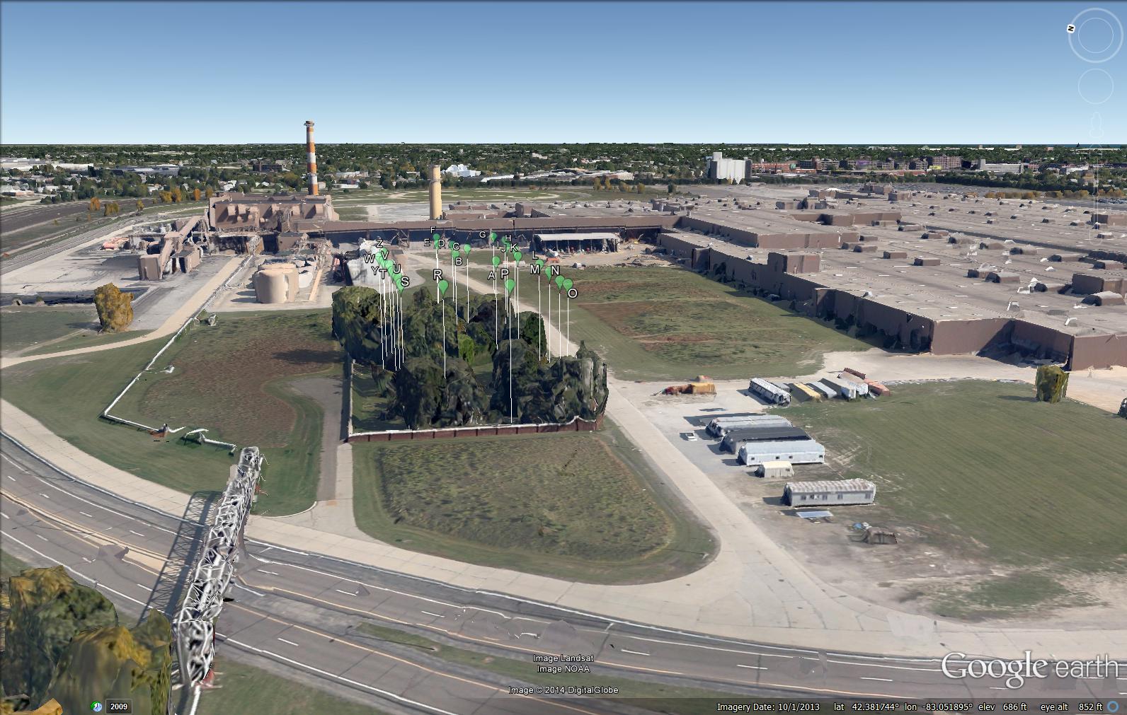
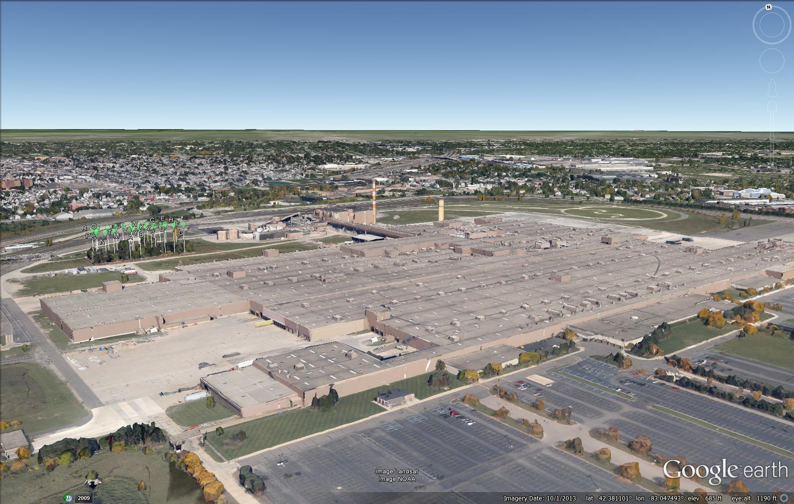
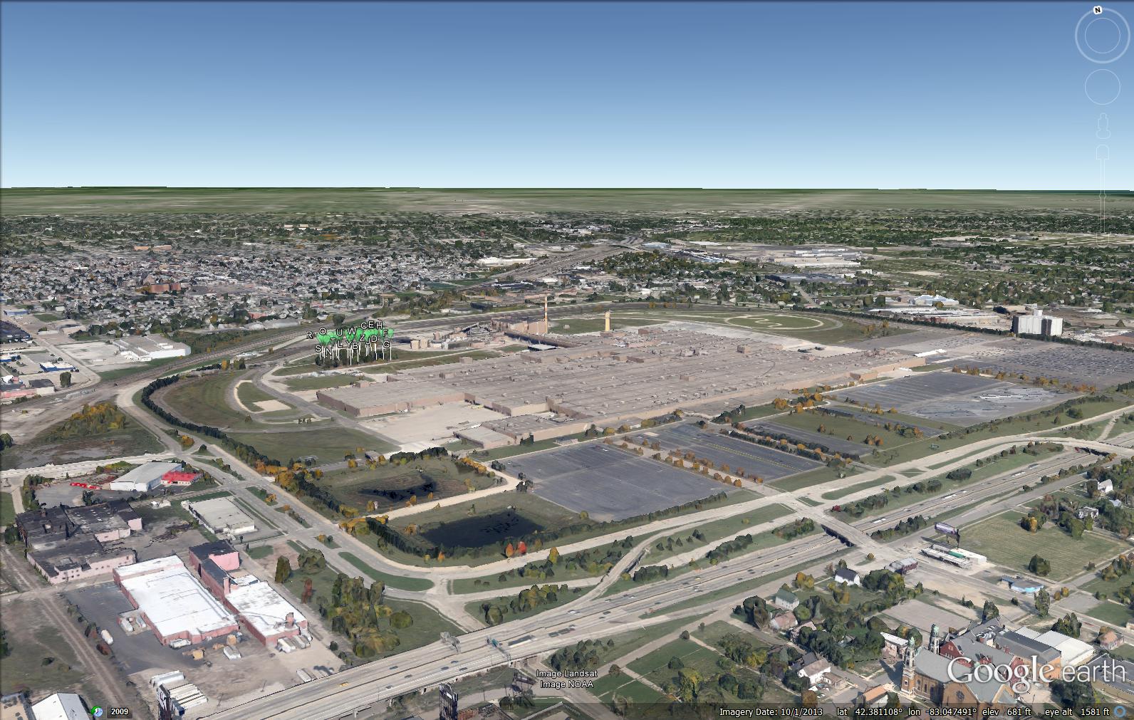
The set of three static images below, captured from
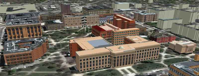
Google Earth, show the site of Beth Olem cemetery within the Cadillac
Plant, in Hamtramck Michigan, near downtown Detroit.
Balloons, Google Earth placemarks, placed virtually in the cemetery are
30 meters high. Plant buildings and
roads surround the cemetery. This set of scenes suggests the
power of cemetery zoning and associated acquisition issues in
protecting lands. In that regard, it may serve as a useful
display with municipal authorities in illustrating the need to employ
cemetery zoning to protect other fragile lands, engaging in multiple
land use planning tactics. Such a strategy has been the focus of
the ongoing Perimeter Project (see references at the end of this
article) and this particular study may bolster some of the arguments
already employed.
 |
 |
 |
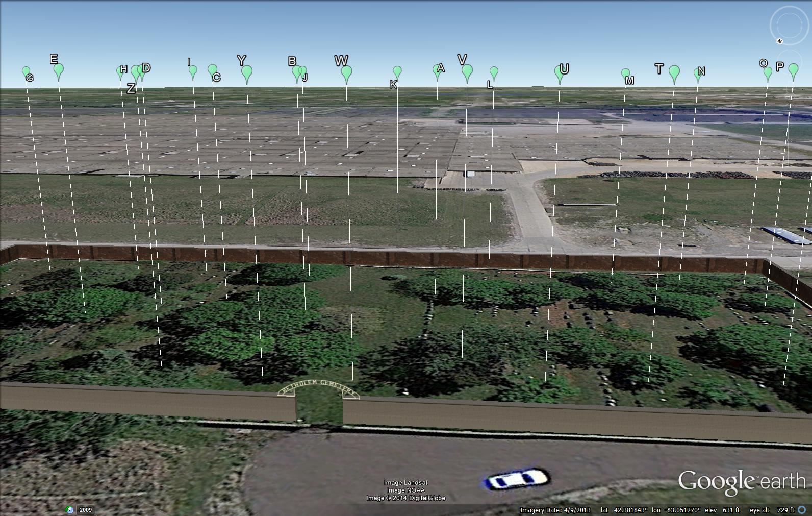
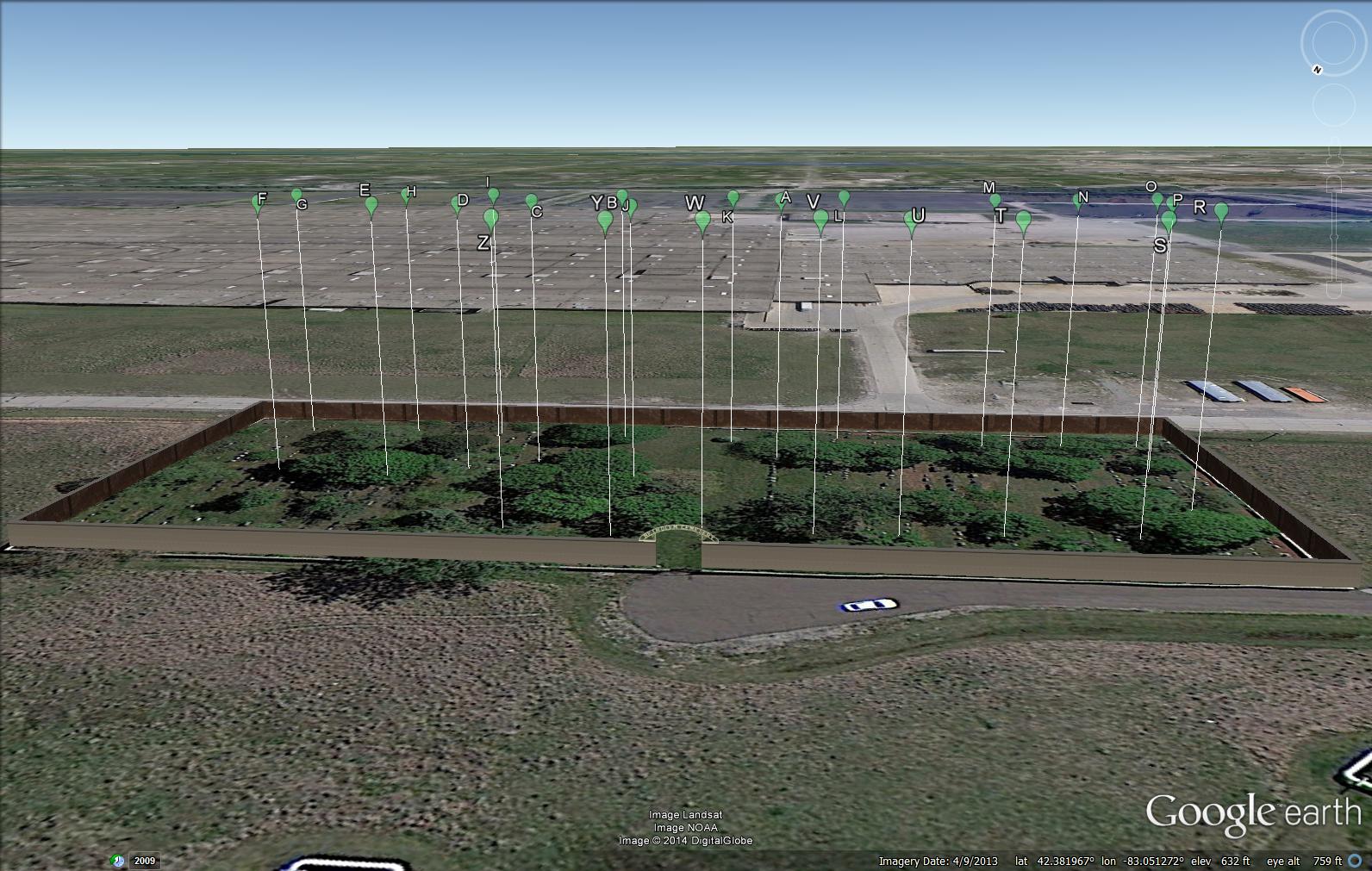
THE SITE
The first image below
shows a close-up of the scatter of
alphabet balloons within the cemetery. These are placed for
organizational purposes only. They serve to group the 1643
entries associated with this cemetery in Find-A-Grave. The
utility of this particular site was noted by Duane Marble and supported
some draft work of the author, encouraging her to proceed in this
direction, at least as a partial step toward the further extensive
acquisition of direct data. Clicking on these balloons in the
static image will reveal
no further information. The Google Earth switch for 3D buildings
and trees has been disabled so as not to mask the detail of the
cemetery. Only the 3D structure of the walls,
modelled by the author in Sketchup, appears in this image and in the
related animation.
 |
 |
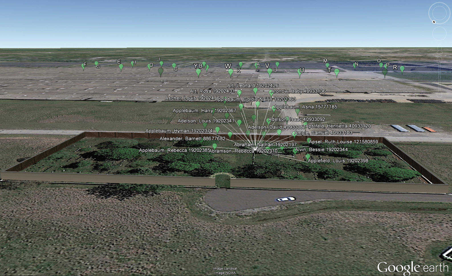
ANIMATION OF THE DATABASE WITHIN THE
SITE
The animation below is made from the associated
Google Earth kml/kmz file linked at the top of this article.
Clicking on the animation itself will
reveal nothing further. Clicking on individual balloons in Google
Earth in the linked file will reveal whatever is available online in
the
Find-A-Grave site. As the accumulated information in the database
grows, so too will the animation.
 |
THE
FUTURE
a. It remains to acquire geographic
coordinates, using the GPS capability of smart phones, for each grave
site and perform a similar analysis and
graphic display.
b. In the case of Louis Lavine, there is
an extra balloon with a GEOMAT timeline embedded in it to suggest that
there will be a link from there to a GEOMAT (see associated reference)
about his life. Then, similar archival structures will follow as
data becomes available to use, either in a public or passworded format.
c. Employ strategies from this project
elsewhere in existing projects:
i. Chene
Street History Project
ii. The
Perimeter Project
REFERENCES
Chene Street History
Project: http://irlee.umich.edu/?page=chene-street
Find-A-Grave Beth
Olem site:
http://www.findagrave.com/cgi-bin/fg.cgi?page=cr&CRid=112
GEOMAT:
http://www.geomats.org/
Marble, Duane:
correspondence noting the materials in Find-A-Grave
Solstice: An
Electronic Journal of Geography and Mathematics:
http://www.imagenet.org
- December,
2013. Sandra Lach Arlinghaus.
Klein
4 Group: Beth Olem Cemetery Application
- The
Perimeter Project, Sandra L. Arlinghaus and William E. Arlinghaus
- December,
2011. The
Perimeter Project, Part 6
Connections:
Scholarly Multi-tasking in a Mobile Virtual World, Part 3.
- June,
2011. The
Perimeter Project, Part 5
Connections:
Scholarly Multi-tasking in a Mobile Virtual World, Part 2.
- December,
2010
The
Perimeter Project, Part 4:
Connections:
Scholarly Multi-tasking in a Mobile Virtual World
Associated .kmz
file
- June,
2010
The
Perimeter Project, Part 3:
Fragile Lands
Protection
Using Cemetery Zoning
Associated
.kmz
file
- December 2009
The
Perimeter Project, Part 2:
Fragile
Lands
Protection
Using Cemetery Zoning
Associated .kmz
file
- June,
2009
The
Perimeter Project:
Fragile
Lands Protection
Using Cemetery Zoning
|