Volume II, Book 1:
Scientific, Planning, Humanitarian, and Teaching Applications, From DevInfo to Google Earth
ASSESSMENT--AFRICA
FIGURE 5.1: Animation. The goal of this sequence of images is to show the reader one way to edit files in Google Earth so that coplanar polygons are eliminated.
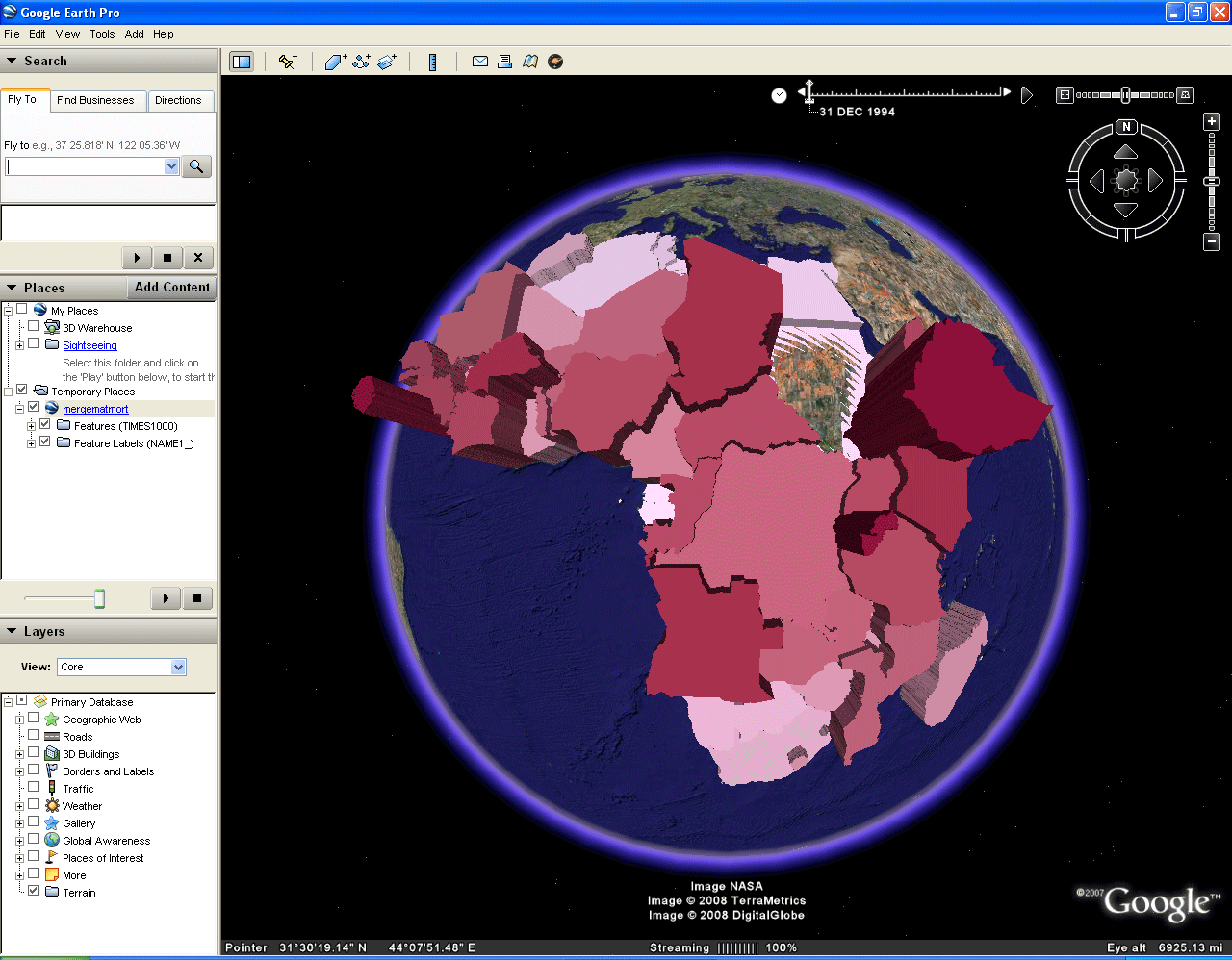 |
FIGURE 5.1: Static frames of the
animation. The
goal of this sequence of images is to show the reader one way to edit
files in Google Earth so that coplanar polygons are eliminated.
 FIGURE 5.1a: Begin with last frame of Figure 4.3. Notice that the shading on the Sudan is not clear. That is because the polygon forming the base is coplanar with some of the polygons forming the aerial. There is no data and height is set to zero. |
 FIGURE 5.1b: Open up the kml file a bit more using the dropdowns on the left. |
 FIGURE 5.1c: Continue opening the dropdowns, exposing entries with 0. Notice that these are clicked on. |
 FIGURE 5.1d: Click off the zero entries. Scroll down to get them all. |
 FIGURE 5.1e: With all zero entries clicked off, the file appears as above. |
TABLE OF CONTENTS
- INTRODUCTION: Assessment, Analysis, and Action--Community Systems Foundation Approach
- ASSESSMENT:
Software
used in analysis:
- DevInfo
5.0: http://www.devinfo.org/
- Adobe® PhotoShop and ImageReady
- Adobe® DreamWeaver
- ESRI:
- ArcView® 3.2
- ArcGIS® 9.2
- ArcCatalog®
- ArcMap®
- Google Earth®
Author
affiliations:
- Arlinghaus, Sandra Lach. Adjunct Professor of Mathematical Geography and Population-Environment Dynamics, School of Natural Resources and Environment, The University of Michigan. Executive Committee Member (Secretary) Community Systems Foundation, sarhaus@umich.edu, http://www-personal.umich.edu/~sarhaus/
- Naud, Matthew. Environmental Coordinator and Assistant Emergency Manager, Systems Planning Unit, City of Ann Arbor
- Oswalt, Kris S. President, Community Systems Foundation
- Rayle, Roger. Scio Residents for Safe Water
- Lars Schumann. Manager and
Research Computer Specialist, University of Michigan 3D Laboratory at
the Duderstadt Center; also of Cornell University, Ithaca NY
- Arlinghaus, William C. Professor of Mathematics and
Computer Science, Lawrence Technological University, Southfield, MI
- Arlinghaus, William E. General Manager, Chapel Hill Memorial Gardens, Grand Rapids, MI
- Batty, Michael. Bartlett Professor of Planning and Director of the Centre for Advanced Spatial Analysis (CASA) at University College London
- Haug, Robert. Ph.D. Candidate, Middle Eastern and
North African Studies, The University of Michigan
- Larimore, Ann Evans. Professor Emerita, Residential College, The University of Michigan
- Longstreth, Karl. Head, Map Library, The
University of Michigan
- Nystuen, Gwen L. Parks Advisory
Commission; Environmental Commission;
City of Ann Arbor
- Nystuen, John D. Professor Emeritus of Geography and
Urban Planning, Taubman College of Architecture and Urban Planning, The
University of Michigan. Chief Executive Officer, Community
Systems
Foundation
Published by:
Institute of Mathematical Geography
http://www.imagenet.org
http://deepblue.lib.umich.edu/handle/2027.42/58219
August, 2008.
Copyright by Sandra Arlinghaus, all rights reserved.