Volume II, Book 1:
Scientific, Planning, Humanitarian, and Teaching Applications, From DevInfo to Google Earth
ASSESSMENT--AFRICA
FIGURE 2.9: Animation. The goal of this sequence of images is to show the reader how to change entries in a database field, in ArcView 3.2/3.3, using the "edit" button. Frequent use will be made of the Windows universal commands, on highlighted text, of "ctrl +c" for "copy" and "ctrl +v" for "paste."
...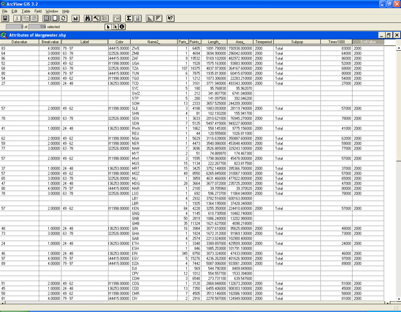 |
FIGURE 2.9:
Static frames of the animation. The
goal of this sequence of images is to show the reader how to change
entries in a database field, in
ArcView 3.2/3.3, using the "edit" button. Frequent use will be
made of
the Windows universal commands, on highlighted text, of "ctrl +c" for
"copy" and "ctrl +v" for "paste."
. FIGURE 2.9a: The screen that remains from the previous sequence. The table is still in editable format. |
. FIGURE 2.9b: Find the "Edit" button and click on it. |
. FIGURE 2.9c: Click on the top entry in the new field. |
. FIGURE 2.9d: Type over the entry of "2000" with "2008." With "2008" highlighted, hit "ctrl +c". |
. FIGURE 2.9e: Click on the entries, one at a time, below the first one. Hit "ctrl + v" each time to replace the old "2000" with the new "2008". |
 FIGURE 2.9f: Continue this process until the entire column is filled. One at a time replacement is easy to do for relatively small databases such as this one. When working with larger databases, it may be more efficient to export the attribute file to Excel, use spreadsheet commands to make batch replacements, and then save the edited spreadsheet as the attribute file in .dbf format. Both strategies work well. Sometimes one is faster than the other. Experience is a good guide for making the selection in particular cases. |
TABLE OF CONTENTS
- INTRODUCTION: Assessment, Analysis, and Action--Community Systems Foundation Approach
- ASSESSMENT:
Software
used in analysis:
- DevInfo
5.0: http://www.devinfo.org/
- Adobe® PhotoShop and ImageReady
- Adobe® DreamWeaver
- ESRI:
- ArcView® 3.2
- ArcGIS® 9.2
- ArcCatalog®
- ArcMap®
- Google Earth®
Author
affiliations:
- Arlinghaus, Sandra Lach. Adjunct Professor of Mathematical Geography and Population-Environment Dynamics, School of Natural Resources and Environment, The University of Michigan. Executive Committee Member (Secretary) Community Systems Foundation, sarhaus@umich.edu, http://www-personal.umich.edu/~sarhaus/
- Naud, Matthew. Environmental Coordinator and Assistant Emergency Manager, Systems Planning Unit, City of Ann Arbor
- Oswalt, Kris S. President, Community Systems Foundation
- Rayle, Roger. Scio Residents for Safe Water
- Lars Schumann. Manager and
Research Computer Specialist, University of Michigan 3D Laboratory at
the Duderstadt Center; also of Cornell University, Ithaca NY
- Arlinghaus, William C. Professor of Mathematics and
Computer Science, Lawrence Technological University, Southfield, MI
- Arlinghaus, William E. General Manager, Chapel Hill Memorial Gardens, Grand Rapids, MI
- Batty, Michael. Bartlett Professor of Planning and Director of the Centre for Advanced Spatial Analysis (CASA) at University College London
- Haug, Robert. Ph.D. Candidate, Middle Eastern and
North African Studies, The University of Michigan
- Larimore, Ann Evans. Professor Emerita, Residential College, The University of Michigan
- Longstreth, Karl. Head, Map Library, The
University of Michigan
- Nystuen, Gwen L. Parks Advisory
Commission; Environmental Commission;
City of Ann Arbor
- Nystuen, John D. Professor Emeritus of Geography and
Urban Planning, Taubman College of Architecture and Urban Planning, The
University of Michigan. Chief Executive Officer, Community
Systems
Foundation
Published by:
Institute of Mathematical Geography
http://www.imagenet.org
http://deepblue.lib.umich.edu/handle/2027.42/58219
August, 2008.
Copyright by Sandra Arlinghaus, all rights reserved.