| SOLSTICE: An Electronic Journal of Geography and Mathematics Persistent
URL: http://deepblue.lib.umich.edu/handle/2027.42/58219
|
 |


Works best with a high speed internet connection.
| SOLSTICE: An Electronic Journal of Geography and Mathematics Persistent
URL: http://deepblue.lib.umich.edu/handle/2027.42/58219
|
|
December, 2012 |
|
Part
2. Geosocial
Networking: A Case from Ann Arbor, Michigan
David E. Arlinghaus and Sandra L. Arlinghaus Associated .kmz download.  Social networking is
an idea that is familiar to many of us: from Facebook, to Twitter, to
LinkedIn, to a host of others that come and go. More recent,
however, is the idea of "geosocial networking" or "collaborative
mapping." According to Wikipedia (2012),
"Geosocial
Networking is a type of social networking
in which geographic services and capabilities such as geocoding
and geotagging are used to enable additional social
dynamics.[1][2]
User-submitted location data or geolocation
techniques can allow social networks to connect and coordinate users
with local people or events that match their interests. Geolocation on
web-based social network
services can be IP-based or use hotspot trilateration.
For mobile social networks, texted location information or mobile phone tracking can enable location-based services to enrich
social networking."
As the authors noted in the previous volume of Solstice (Volume XXIII, Number 1),
Washtenaw County, Michigan embarked on a
major stream bank erosion control project. When
that project entered heavily forested
residential lands adjacent to
a creek, environmentally-sensitive residents quite naturally became
concerned
for the trees and wildlife that will be destroyed or disturbed. The project is still on-going and the geosocial
network described below remains in place. The County coded its easement with pink flags. It tagged selected large trees or otherwise
interesting vegetation with a blue band if they were to be removed; it
tagged
trees within the easement with a red band if they were to be left alone. All vegetation within the easement, except
trees or shrubs carrying red tags, were to be removed.
Color was critical—a simple red/blue
confusion could cost a tree its life! One
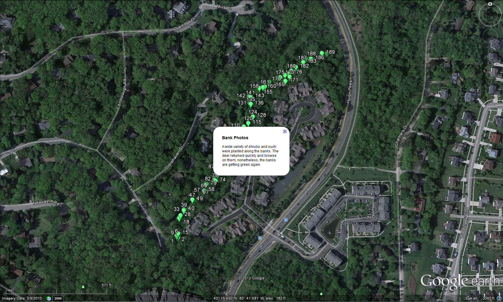
neighborhood used Google Earth, together with a
GPS-enabled smartphone, to make an inventory of trees present, along a
half-mile stretch of the creek, before the project began. David
E. Arlinghaus did all the photography
with a smartphone that geotagged the images.
He then transmitted the images to Sandra L. Arlinghaus who did the
mapping using a combination of GeoSetter and Google Earth
(Figure 1).
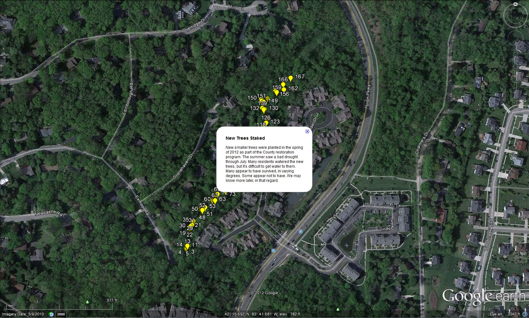
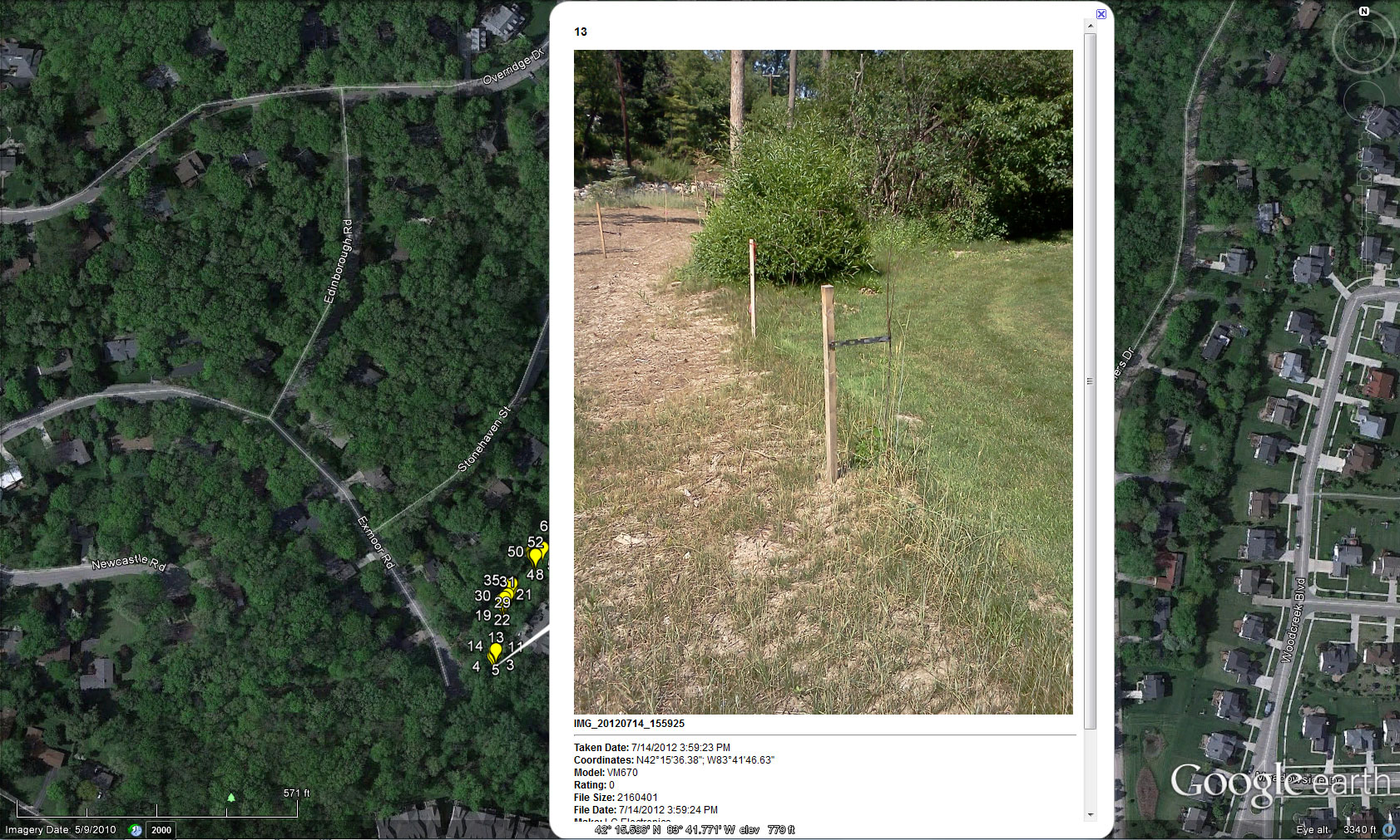
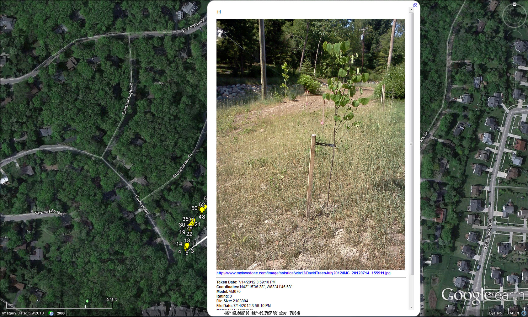
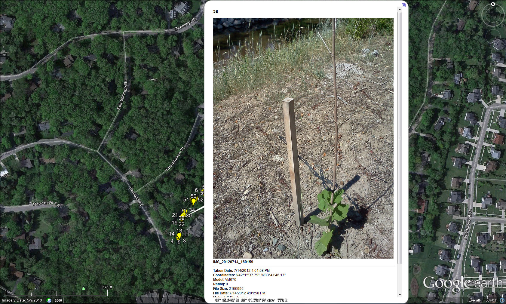
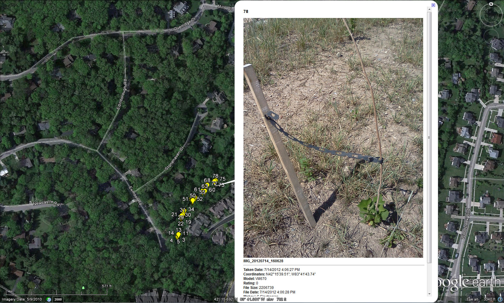
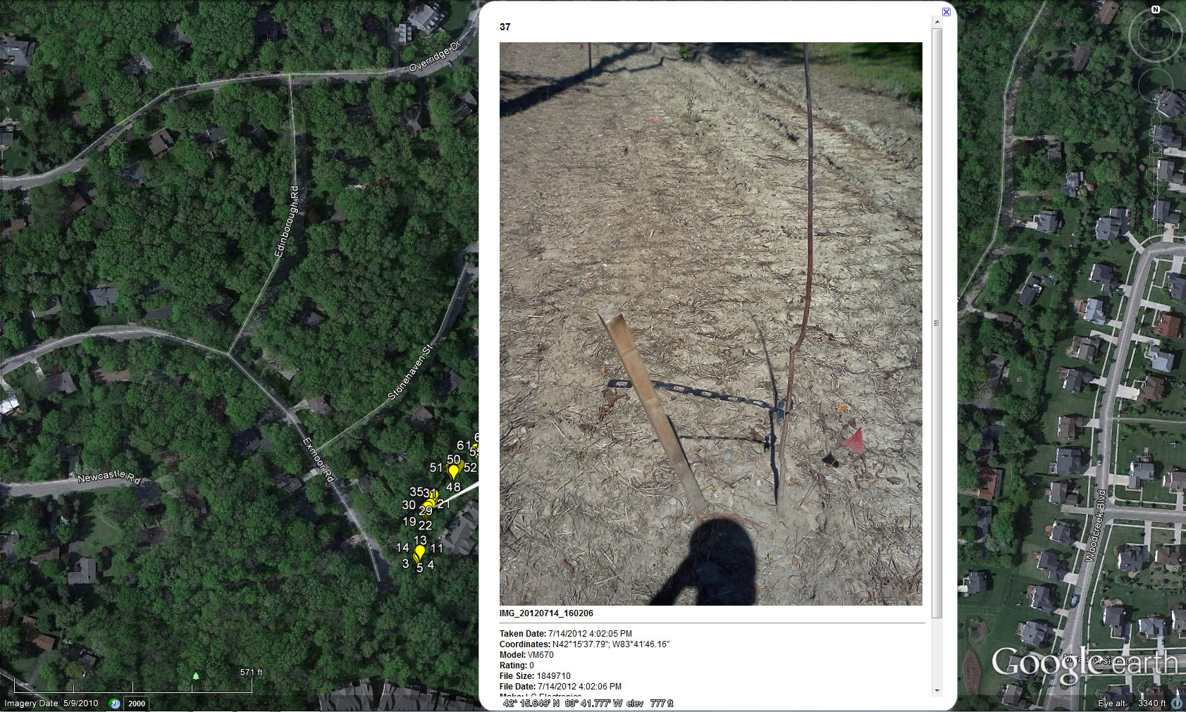
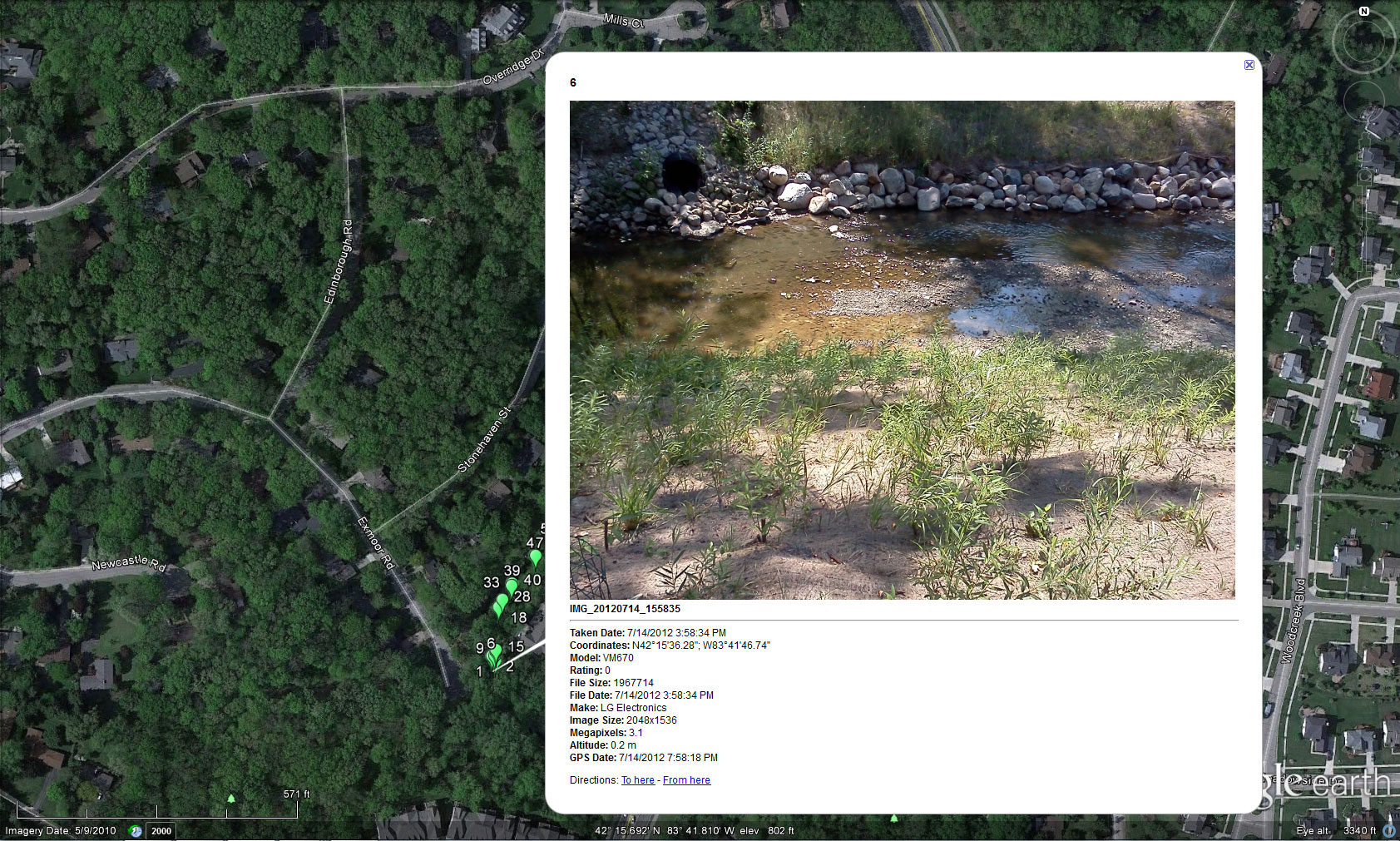
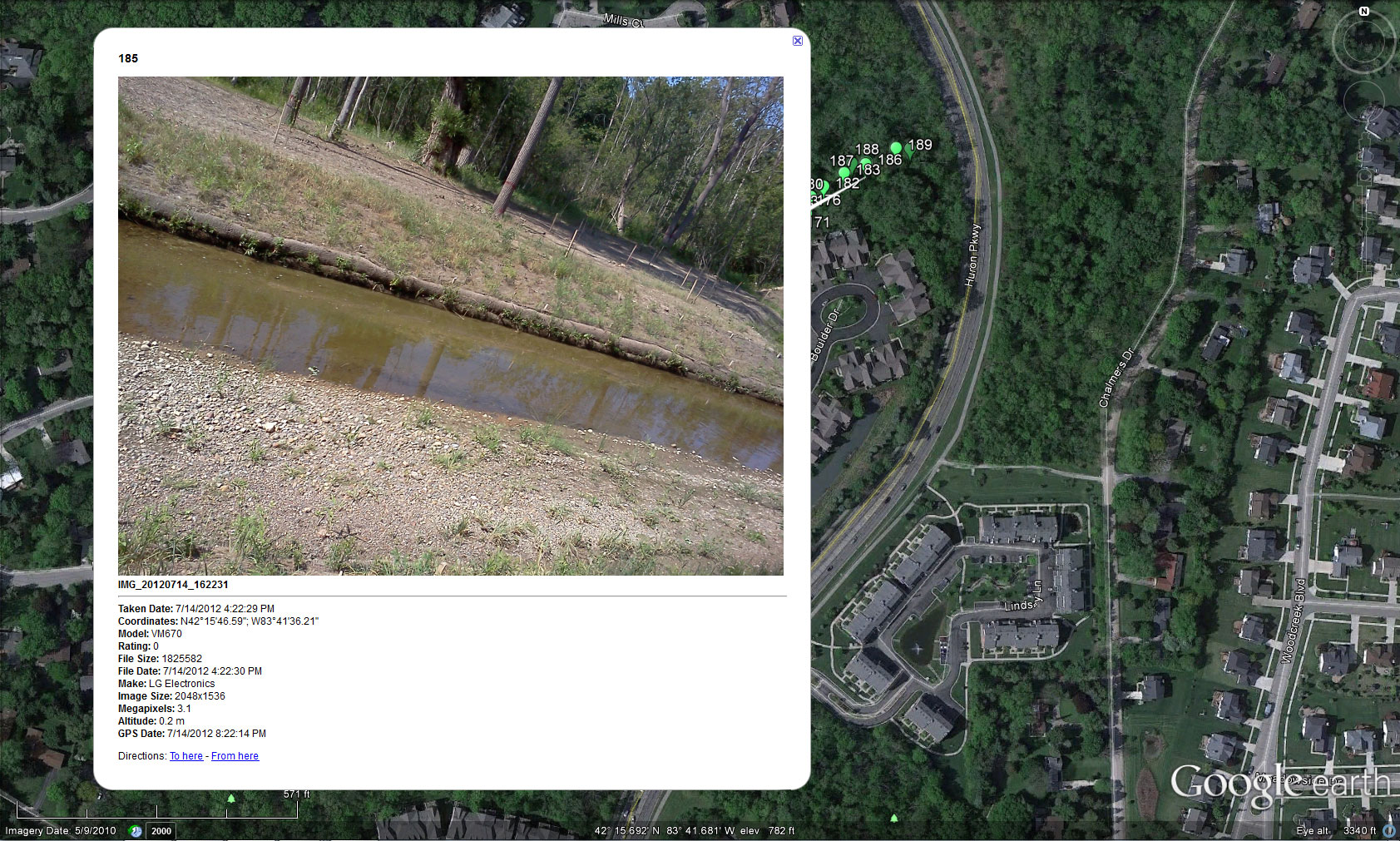
Follow up in July of 2012, following the removal of trees and stream bank stabilization enabled the neighborhood to continue to track the progress of the project. Figures 2 through 8 show a sequence of screen captures from the field photographs. Figures 2 through 6 show the successes and failures (related to a drought) of larger, staked plantings. Figures 7 and 8 shows two of the many stream bank photos designed to illustrate the broader vegetation restoration. Captions reveal some of what can be noted; however, to get a full view, download the linked .kmz file at the top of this article and open it in Google Earth. In that way, the reader of this article can follow along with what is happening in this territory without having to walk through the somewhat difficult terrain! Follow where the county is spending tax payer dollars on an important environmental restoration project! |
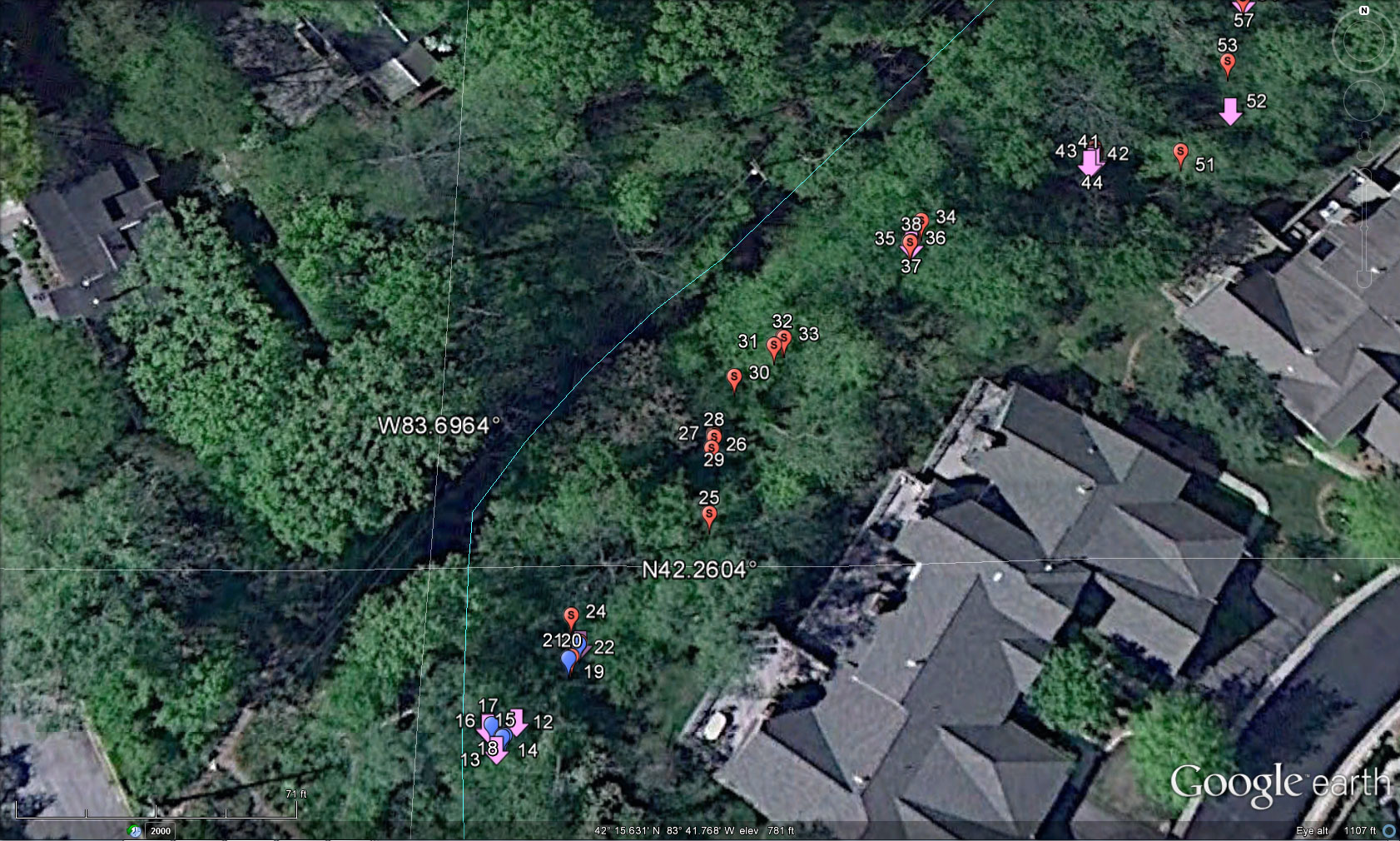
| The
accuracy of the geotagging of the photos was limited by
several factors. First, the software in
the smartphone has limits. Second, the
geotagging of the tree is actually the geotagging of the camera where
David stood
to take
the picture of the tree, rather than of the tree position,
itself. He attempted to stand at a consistent
distance from trees to ensure precision (but that is difficult in this
terrain). The level of precision,
however, was quite good—trees were in correct relation to each other
and in
close to correct relation to dwelling units.
The geotagged camera images were downloaded directly
to a
computer by plugging the smartphone into a recent Windows 7 desktop
computer. The 191 images were stored in a
single
folder. That folder was then uploaded to
the free software called “GeoSetter.” From
there, the geotagged images were batch-uploaded
to Google Earth in
a single operation (rather than entering each one individually). The GeoSetter software was able to take the
underlying geocoded coordinates from the camera images, as well as the
images
themselves, and make them correspond to the underlying coordinate
geometry in
Google Earth. We made color decisions to
correspond with the actual colors of tags used on vegetation. Accuracy,
of registration of photo and Google Earth
coordinates, using this sort of strategy was guaranteed. Hand
placement would not offer that level of
accuracy of registration. Overall, the results were sufficiently
precise
(although not accurate) to offer local residents a clear picture of
what did happen in their local wooded areas. When
the
camera GPS coordinates were obtained, a photo of the tagged item was
also
taken. The figures below show the photo pointing to a
location. These pointing associations are all accurate. |
| The
neighborhood association established a tree
monitoring
committee. The committee was given
a Google Earth file showing tree location and associated tag
color.
The easement was also geocoded. Prior to using the file, the
neighborhood
association president and the creator of the
Google Earth display met with the lead County official and the lead
engineer on the project to ensure a cooperative approach to file
usage.
Subsequently, the tree monitoring committee used the information in
conjunction with field-checking vegetation. Geosocial networking
was, and is (through remaining tree restoration scheduled in spring
2013),
critical in developing a
constructive relationship among the various parties adjacent to this
well-meant and successful evironmental stream-bank restoration project.
References
Numerous people were involved directly and indirectly in this project that brought together County and City officials, Engineers from a local engineering firm, and members of the public from a variety of neighborhoods including differing residential types and zoning. We thank: Harry Sheehan, Greg Marker, Jane Lumm, Roger Rayle, Janice Bobrin, Matt Naud, and all the member neighborhoods of the Huron Valley Neighborhood Alliance and the individuals from those neighborhoods who participated in so many helpful ways. |
 |
|||
| 1.
ARCHIVE 2. Editorial Board, Advice to Authors, Mission Statement 3. Awards
|
|
.

Solstice:
An Electronic Journal of Geography and Mathematics, |
|
Congratulations to all Solstice contributors. |
| Remembering
those who
are gone now but who contributed in various ways to Solstice
or to IMaGe
projects, directly or indirectly, during the first 25 years of IMaGe: Allen K. Philbrick | Donald F. Lach | Frank Harary | William D. Drake | H. S. M. Coxeter | Saunders Mac Lane | Chauncy D. Harris | Norton S. Ginsburg | Sylvia L. Thrupp | Arthur L. Loeb | George Kish | |