Sandra L. Arlinghaus
| Download
Google
Earth |
| Download
kmz files to open in Google Earth: phones.kmz. |
Maps of emergency telephone networks are naturally important: public safety is enhanced when the local population knows where to look for a systematically distributed network of phones. Recent 3D software offers one way to enhance transmission of information. Thus, in this note, locations for campus emergency phones at The University of Michigan, Ann Arbor, are cast in Google Earth. Indeed, given Ann Arbor's recent ranking as the most "pedestrian friendly" city in Michigan [Ann Arbor.com], such networks become all the more important in ensuring that "friendliness"!
Take a look at the screen captures below. Figure 1 shows the distribution of emergency phones across the entire campus; each phone is positioned, approximately, using the map that appeared in the recent campus safety handbook. Individual phones are represented by light cyan balloon placemarks that will shrink in size as one zooms in within the .kmz file. Load in buildings from Archimedes in the Google Earth 3D Warehouse and take a look at phone location in relations to buildings (Figure 2). Navigate the 3D scene in Google Earth by loading the .kmz file above and create your own scenes as you familiarize yourself with phone locations.
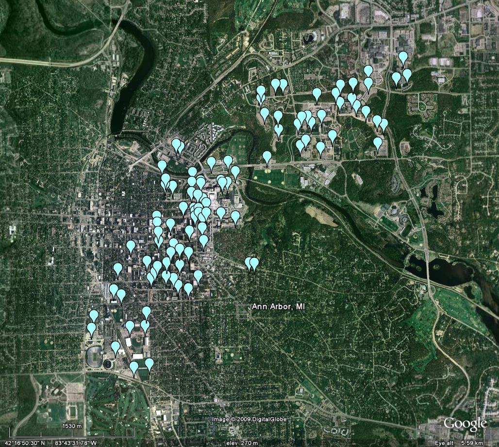 Figure 1. Distribution of emergency phones on the Ann Arbor campus of The University of Michigan. |
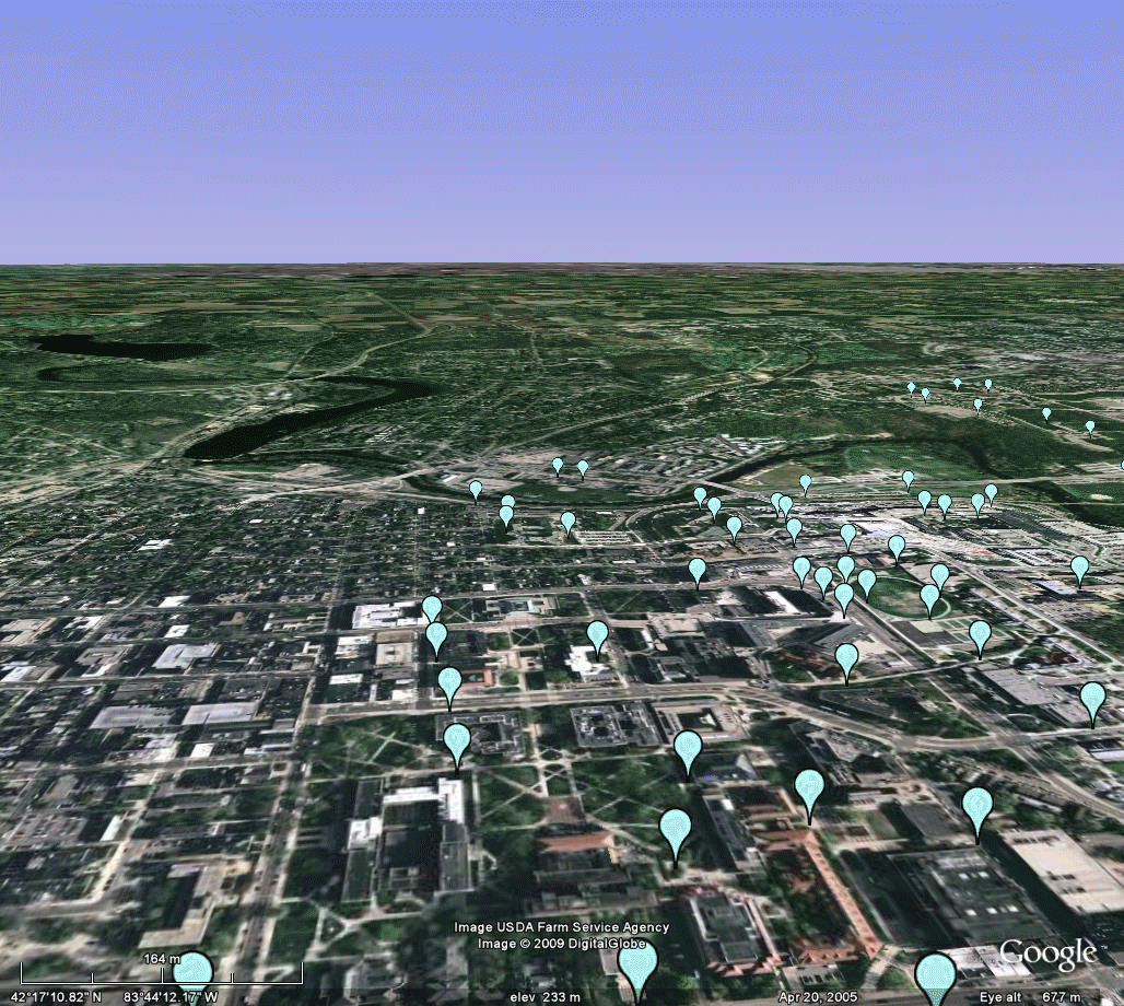 Figure 2. Emergency phones and 3D buildings. |
Emergency phone networks and various locational strategies for determining where to put them have been an object of research interest for many years [Arlinghaus; O'Kelley] and of general interest by scholars [Moellering]. What is exciting here is to consider the role that enhanced visualization might offer to such projects as well as to note its natural public benefit.
REFERENCES
AND SOFTWARE
- Adobe, PhotoShop and ImageReady
- Ann Arbor.com, November 10, 2009.
- Arlinghaus, Sandra L., 1986. Essays on Mathematical Geography. "Topological Exploration in Geography," "Kioskland" example; Monograph Series, Monograph #3. Ann Arbor: Institute of Mathematical Geography.
- Google Earth
- Google SketchUp 3D Warehouse.
- Moellering,
Harold. Personal communication.
- O'Kelley, Morton, Citation List, Ohio State University.
- University of Michigan Campus Safety 2009-2010 Handbook
|
.

Solstice:
An Electronic Journal of Geography and Mathematics,
|
|
Congratulations to all Solstice contributors. |
1964
Boulder Drive,
Ann Arbor, MI 48104
734.975.0246
http://deepblue.lib.umich.edu/handle/2027.42/58219
image@imagenet.org
Ann Arbor, MI 48104
734.975.0246
http://deepblue.lib.umich.edu/handle/2027.42/58219
image@imagenet.org