Sandra Lach Arlinghaus and Robert F. Austin
| Download Google
Earth |
| Download
kmz file to open in Google Earth |
Dedicated to the memory and achievements of Donald F. Lach, 09/24/1917 - 10/26/2000.
To place the visual files supplied in this update into context for the reader, we quote the original introduction by Austin to his Gazetteer of historical Southeast Asian place names.
| INTRODUCTION There are a number of approaches that one may take in compiling a gazetteer. The most logical approach from the perspective of contemporary geographers might be to compile an exhaustive list of toponyms currently in use. The Official Standard Names Gazetteer series prepared by the United States Board on Geographic Names constitute such a compendium, and no attempt has been made to duplicate these documents (although they have been used as the source of latitude and longitude coordinates). Rather historical place-names have been emphasized. Having made a commitment to historical place-names (although the reader will note some contemporary citations for cases of recent official changes), a decision remains with regard to the type of historical entries that would be most useful. In this gazetteer, no attempt has been made to provide spellings or usages that are "correct" in the sense of currently preferable in the academies and institutes of language of the several nations involved. Instead, this is a collection of place-names as they appeared in print. I have not attempted to correct obvious misprints in the original sources, nor have spelling errors been corrected. The entries are recorded here as they were published. Cross-references have been provided to allow the reader to determine the place of reference. There is little value, in an exercise such as this, in telling the reader what Pigafetta, Crawfurd, or other early chroniclers should have written; that is generally obvious. Rather, the real value of this gazetteer lies in its record of the given usage. Although sufficient examples have been included to introduce the subject, no thorough attempt has been made to portray place-name variations arising from the use of different European orthographies (specifically Dutch versus English). As these variations are of a fairly regular nature, users are referred to the dictionaries cited in the bibliography. Throughout at least the historical period in Southeast Asia, the concept of territoriality has differed from that observed in Europe and North America. One of the most striking pieces of evidence for this assertion is related to national boundaries. In general, the kingdoms and states of the region existed as extensions of a central, frequently sacred, capital city. Although at any given time possessing quite well-defined boundaries, the extent and location of those boundaries (and the fortunes of the states) fluctuated, often dramatically. Hence, it is often more appropriate to speak of the center as the state (for example, Ayuthia or Brunei). This issue has generally been resolved, for the purposes of this gazetteer, by citing the geographically smallest entity. Thus Chiengmai is listed as a town, despite the fact that this same name is also applied to a larger political unit. The entries generally take one of two forms. Primary entries include: 1) the current name of a geographical entity; 2) a generic description, unless that is obvious from the name; 3) the nation(s) in which the entity is located (although this gazetteer should not be considered an official authority in this respect); 4) latitude and longitude coordinates; 5) other names which have been applied to each entity in the literature or in common English usage; and 6) occasional supplementary notes. As noted above, latitude and longitude coordinates are taken from the gazetteers of the U.S. Board on Geographic Names for the majority of entries. However, coordinates for certain ancient towns are approximations, and the coordinates supplied for physically large entities are for a central location. Names about which there is some question as to reference are noted with a question mark (?). Such citations are included for the sake of completeness, and should not necessarily be interpreted as an endorsement. Entries of the second type include: 1) a geographical name; 2) a reference (of the form "see _____") to the geographical name currently used to designate that entity; and 3) occasionally, a short bibliographic citation or explanatory note. This is a gazetteer of given use, not prescribed or correct use. As such, this historical place-name cross-reference could be of potential interest to geographers, historians, and other social scientists studying the area. In the present case, a number of other purposes could also be served. Studies of Chinese trade and political relations with Southeast Asia could be facilitated by the material presented here. The same comment may be made with regard to contacts with India and the Arab World. Other uses might include the better comprehension of archaeological sites, research on floral and faunal assemblages based on historical references, and the linguistic and cultural analysis of place-name derivations. It is my belief that this gazetteer could be useful in a variety of other contexts, and it is my hope that the flaws that undoubtedly remain will not detract excessively from that usefulness. Robert F. Austin, 1986. A Historical Gazetteer of Southeast Asia Institute of Mathematical Geography, Monograph Series. Monograph #4 Ann Arbor, Michigan. |
What is missing, however, in the earlier (text only) work is visualization of these placenames. That lack is not a weakness of the work; it is rather a sign of the times. Maps were static; production costs of maps prohibited the use of large numbers of maps. Color production was costly. Portrayal of materials on a globe, in a dynamic fashion, was unheard of. Today, all of those lacks are easily addressed. It is important to address them and bring fine scholarly documents, such as Austin's, into the contemporary realm where they might continue to stimulate others for years to come. The spatial component, and its visualization, is critical to persistence of geographical information.
The visual material below suggests one way to update Austin's contribution by the easy introduction of a substantial spatial component. Only entries from the Gazetteer with coordinates noted there are included in these files (other than in those dealing with benchmarking of files).
- The
animations are made from screen captures of material in
Google
Earth.
- Links
to individual frames, and to movies, are provided for
readers wishing a
closer view and control over individual animation
frames.
- The
reader who is truly serious, however, about augmenting
the text with
optimal visualization capability should download
associated .kmz files
(from the link at the top) and view them in Google
Earth.
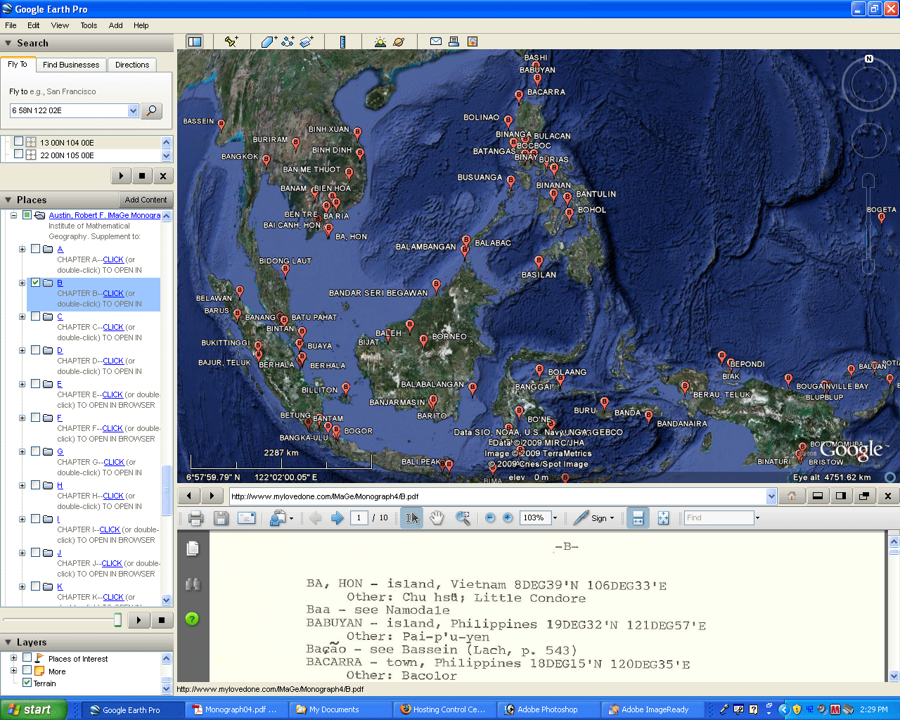
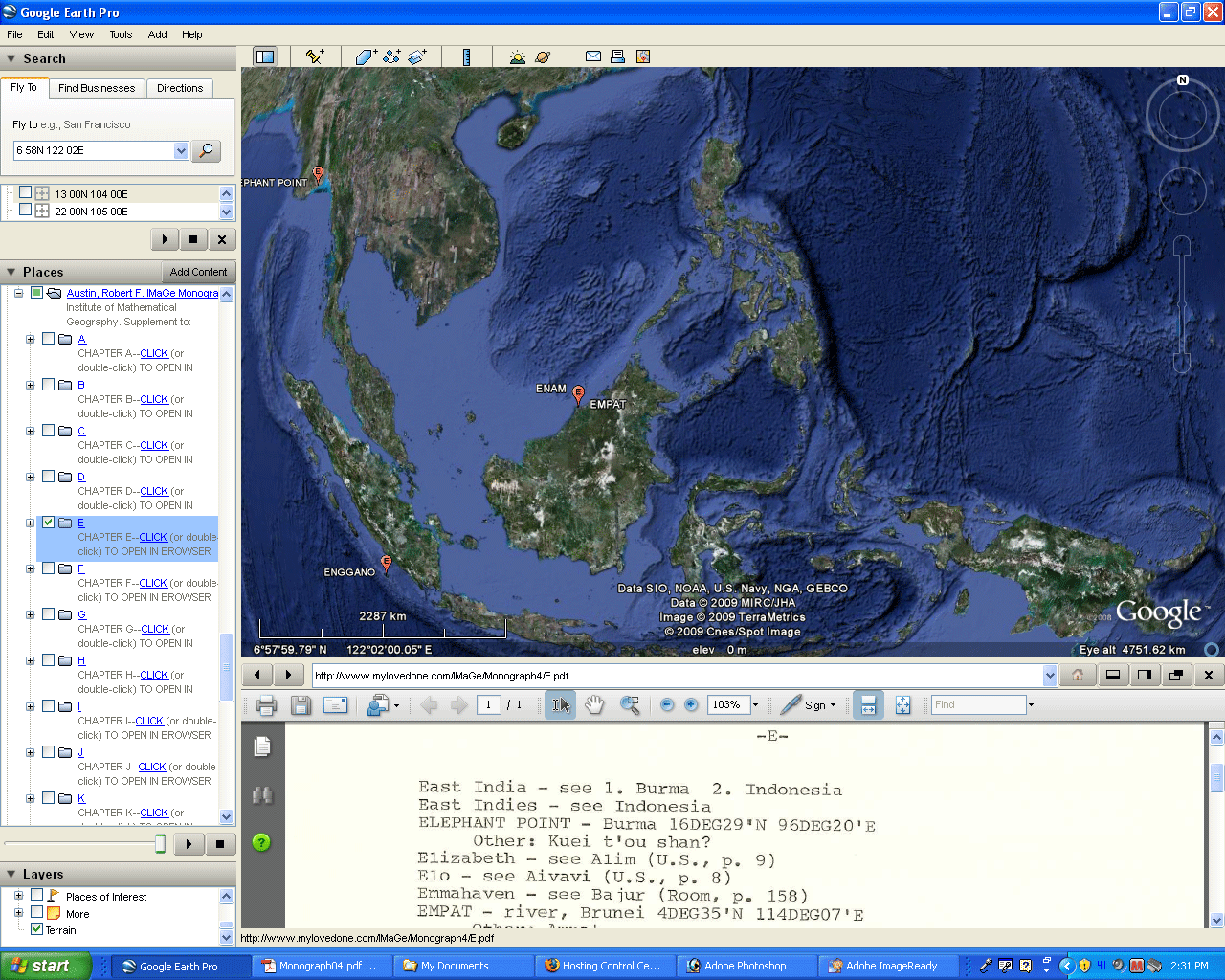
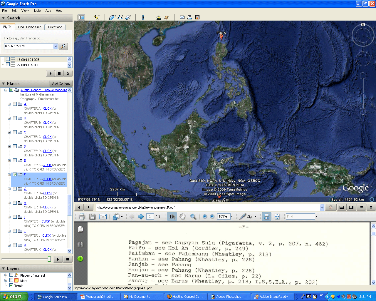
- Figure
1, the most important visualization. See
Austin's work on the
surface of the globe in association with the text, all
within a single
window. View more; use the .kmz file in Google
Earth.
Scroll down in the text section to view the entire
chapter in
association with appropriate images.
- Figure
2. Or, look for patterns in linguistic variation
by first letter
of place name. Why are the names beginning with
C so clustered
while those beginning with other letters are
not? Do observations
such as these offer guidance for research paths not
only in history and
geography but also in far-flung fields such as
linguistics?
- Figure
3. Test the geographic coordinates given in the
Gazetteer against
place names already present in Google Earth.
- Figure
4. Zoom in, take a look around and think about
how what you are
seeing associates with what you already know about the
location and
also think about how it might offer guidance for
related research
paths!
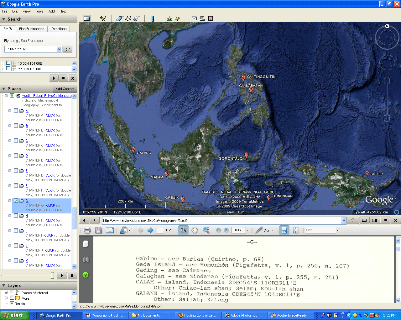
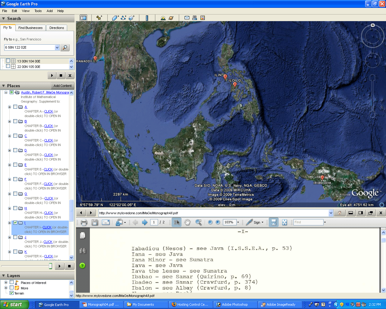
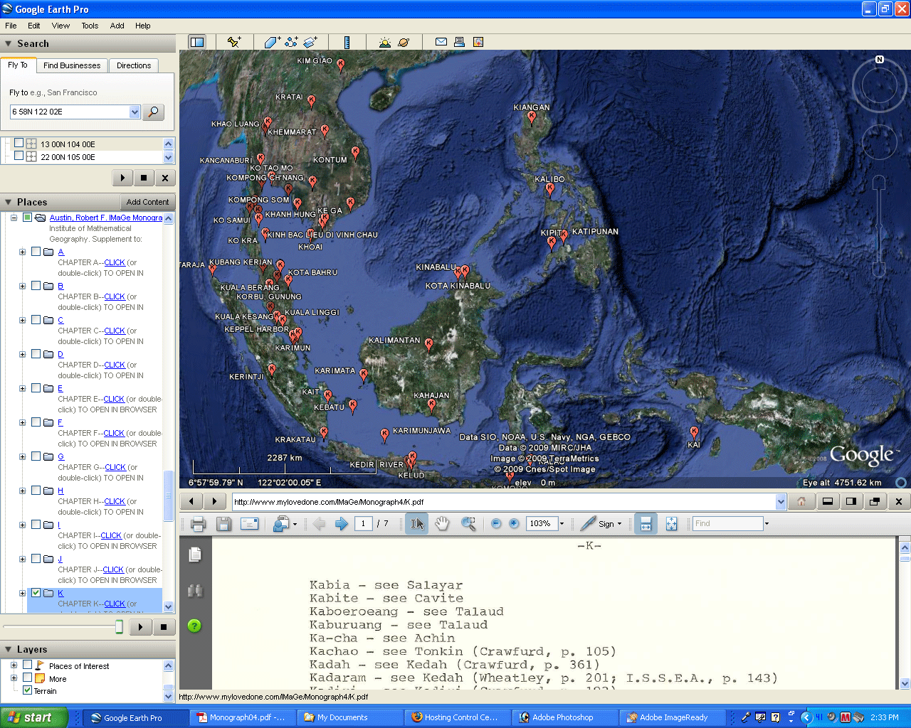
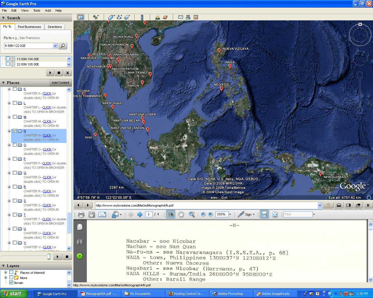
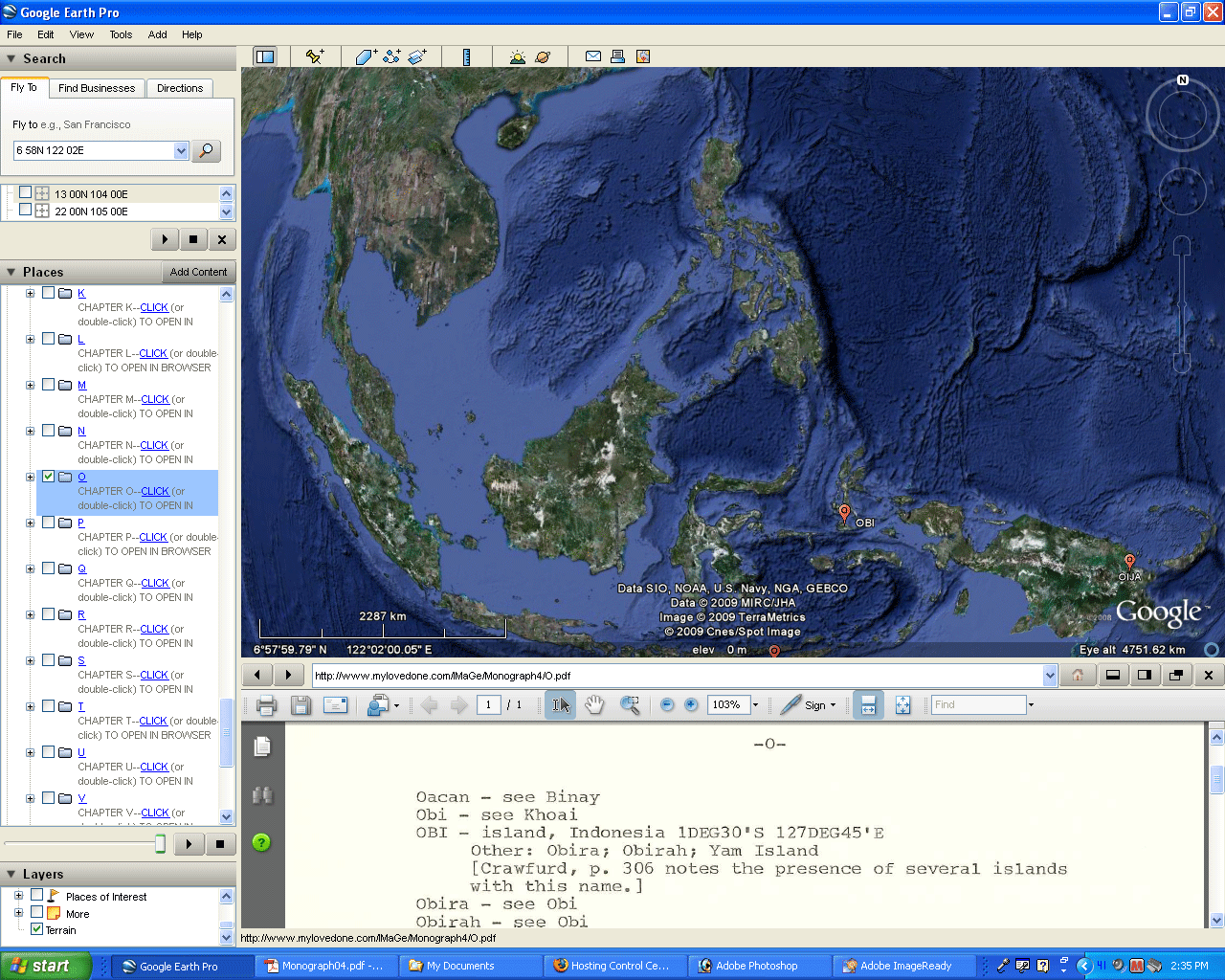
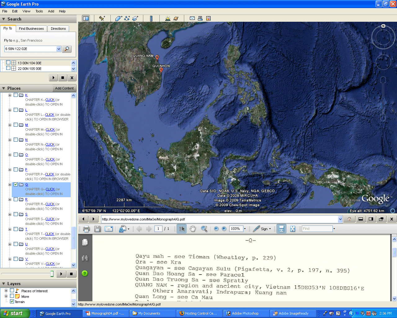
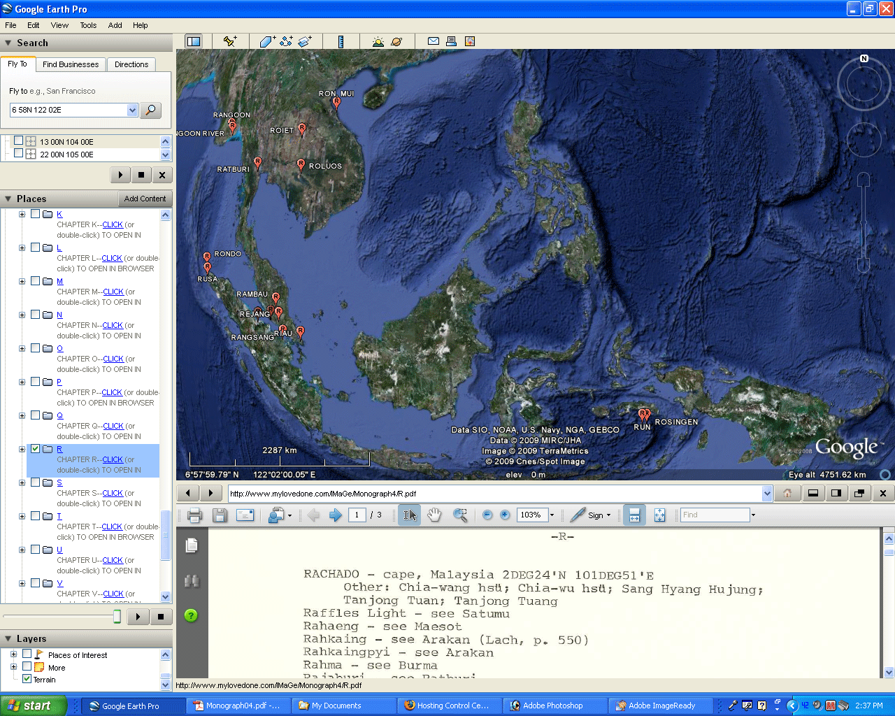
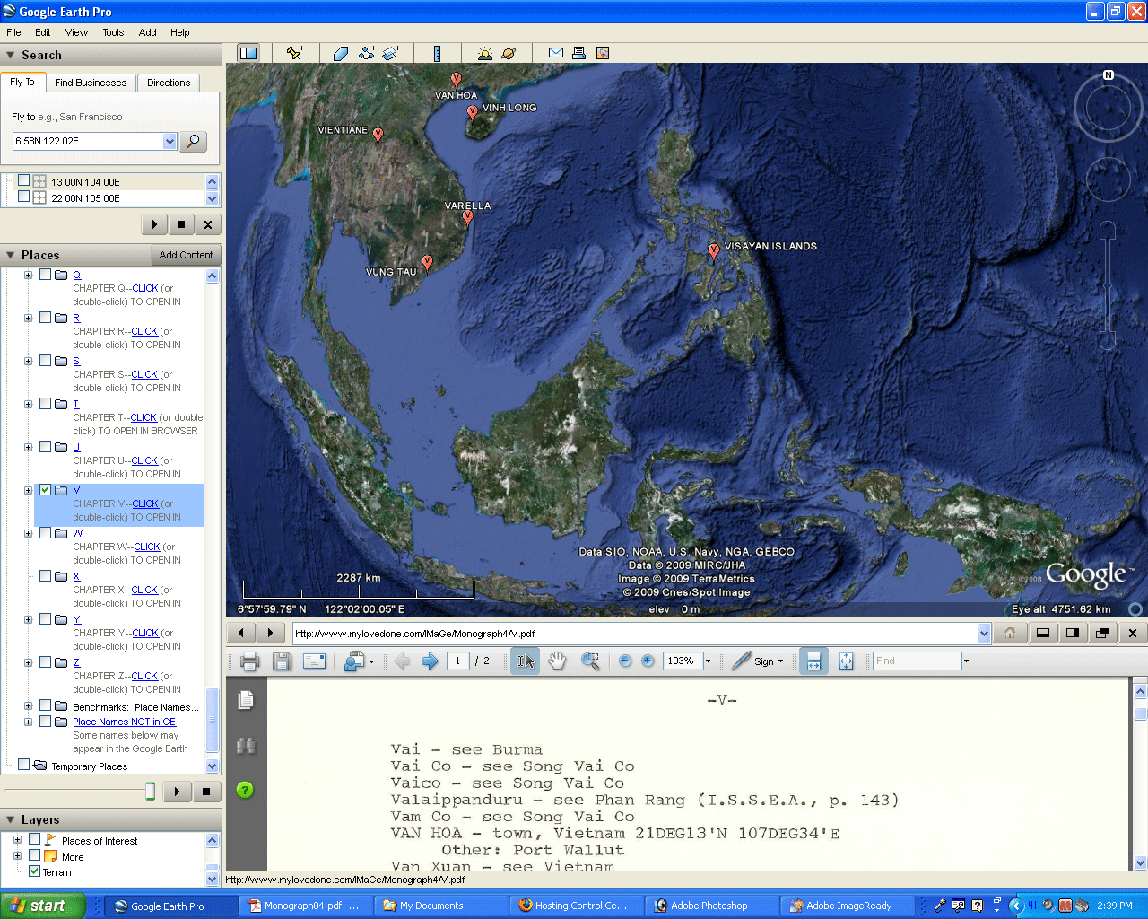
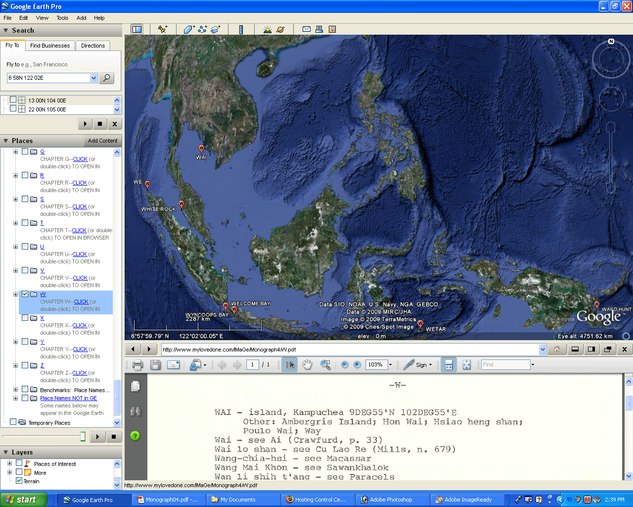
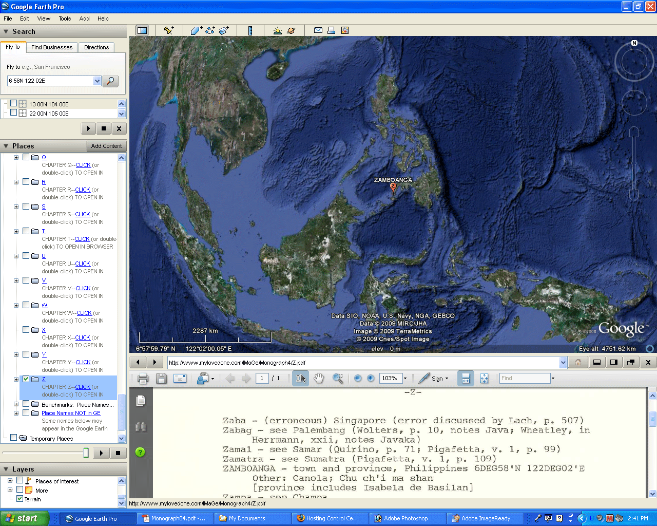
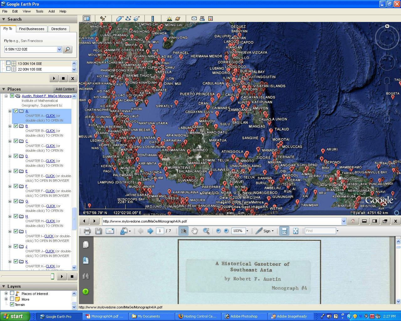
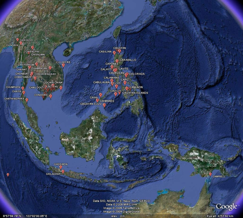
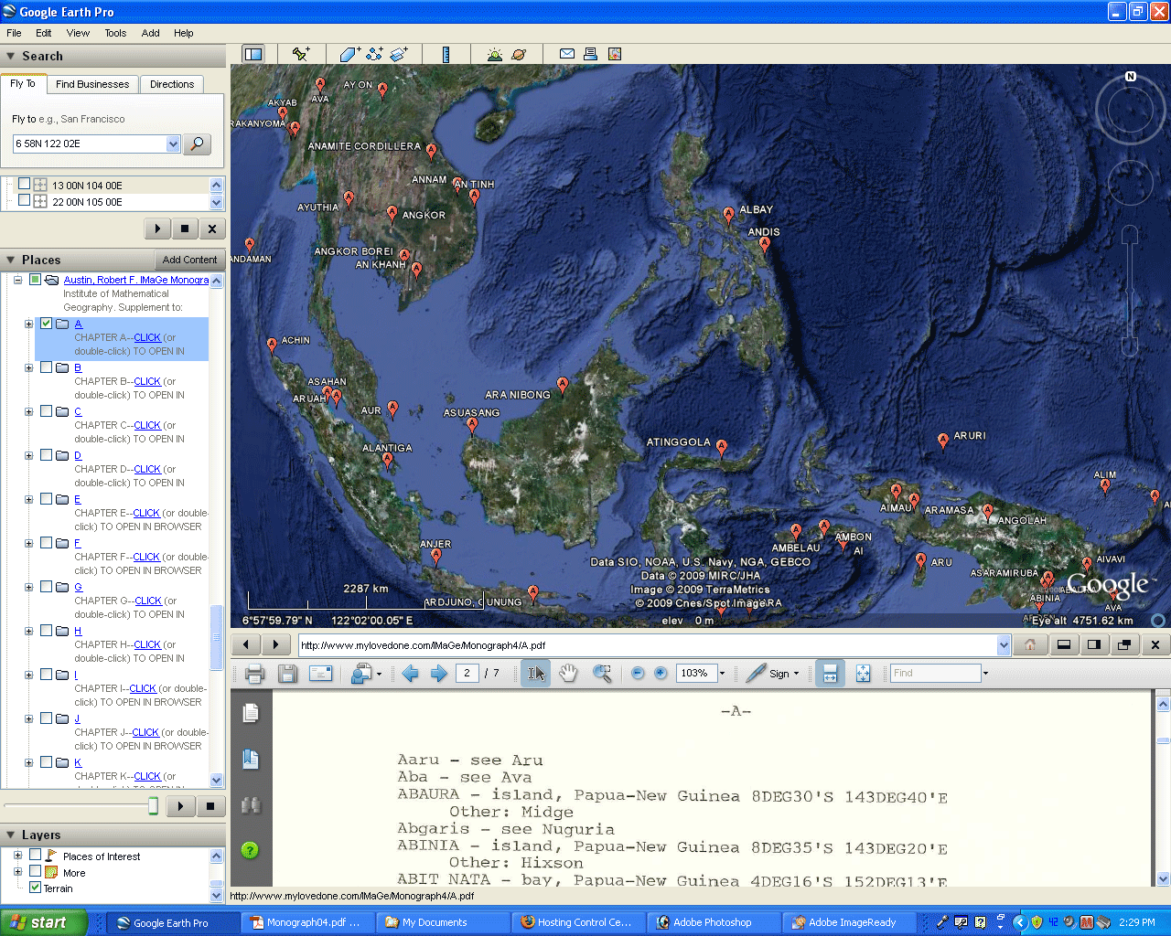 Figure 1. See Austin's work on the surface of the globe in association with the text, all within a single window. Best view: download the Google Earth .kmz file, open Google Earth, pull down file, and choose "open". Then navigate to where you chose to store the .kmz file and open it. Otherwise: Links to individual images: A, B, C, D, E, F, G, H, I, J, K, L, M, N, O, P, Q, R, S, T, U, V, W, X, Y, Z. All layers, together. Link to movie. |
Visualization offers
far more than mere displays to brighten up text. When
used
creatively, it may support existing knowledge in a positive
manner,
suggest related channels for research that were previously
hidden, or
even suggest directions for entirely new research projects
(see Figure
2).
 |
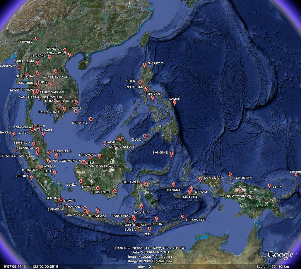 |
| Figure 2. Why are the names beginning with C so clustered while those beginning with S are not? Is that observation of significance or is it simply a consequence of the selection of the subset of names from all names (or both)? |
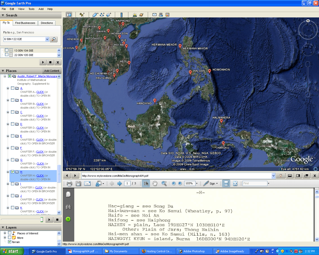
Benchmark the locations in the monograph against locations in the Google Earth default database. Good alignment offers some degree confidence in both. Gaps in alignment offer opportunities for closer looks (see Figure 3).
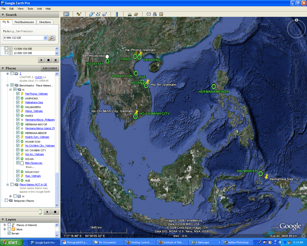 |
| Figure 3. Test the geographic coordinates given in the Gazetteer against place names already present in Google Earth. Here, place names beginning with the letter "H" are used. The green hexagons show Gazetteer place names that also appear in Google Earth together with the yellow markers for the Google Earth locations. In most cases, but not all, the fit is good but not perfect. The case of Hermana Menor and Major cannot be separated at the broader scale and so a closer look is taken. The need to do so gives the reader a clear idea of the coarseness of the scale in terms of separation, or lack thereof, of icons. The set of all Gazetteer place names beginning with H is shown along with the hexagons to suggest the level of coverage between Gazetteer and Google Earth. In the case of this letter, the coverage is about half. Pink triangular icons mark locations in the Gazetteer but not in the Google Earth database. |
View recent Tsunami,
or other environmental, damage in relation to historical
place
names. Think about the traditions and cultural
contexts that
might have been substantially altered in a brief amount of
time.
Consider studying the rebuilding process as the phoenix
rises around
the world.
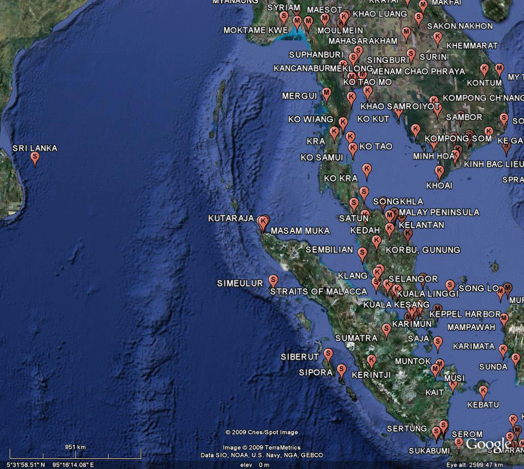 Figure 4. Zoom in, take a look around and think about how what you are seeing associates with what you already know about the location and also think about how it might offer guidance for related research paths! |
Once you are comfortable using Austin's Gazetteer in the Google Earth context, consider bringing in some of the historical maps already present in Google Earth, or add your own as overlays. Integrate GIS maps with a variety of kml/kmz files. Use Google SketchUp to create 3D buildings of your own. The possibilities are endless!
REFERENCES
- Arlinghaus,
Sandra Lach. 2006. Banda
Aceh: A View on the Globe
.
Solstice: An Electronic Journal of Geography and
Mathematics. Ann Arbor: Institute of
Mathematical Geography.
- Austin, Robert F. 1986. A Historical Gazetteer of Southeast Asia. Ann Arbor: Institute of Mathematical Geography.
- Lach,
Donald F.
Asia in the Making of Europe. Volumes I and II;
with E. VanKley,
Volume III. University of Chicago Press.
|
.

Solstice:
An Electronic Journal of Geography and
Mathematics, |
|
Congratulations to all Solstice contributors. |
1964
Boulder Drive,
Ann Arbor, MI 48104
734.975.0246
http://deepblue.lib.umich.edu/handle/2027.42/58219
image@imagenet.org
Ann Arbor, MI 48104
734.975.0246
http://deepblue.lib.umich.edu/handle/2027.42/58219
image@imagenet.org