The Effects of Imperviousness
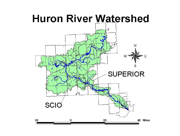
on Watersheds: Scio and Superior Townships
by Mark Brush

First Steps
Find out from city and organizations what
types of analysis they would like to see.
City: City of Ann Arbor
-
Also interested in percentage of imperviousness cover in
a typical development.
-
What type of reductions in imperviousness can we expect with
a cluster development.
-
Further analysis on a planned development in the North-east.
Organization: Huron Watershed Council
-
Work on forecasted impervious cover based on zoning maps
-
See what type of impervious cover could be expected at “build-out”
-
See what types of reductions would be evident with road reductions
-
Percentage of imperviousness cover in a typical development
What path do I choose?
-
Step 1 - get a grasp for how impervious data is calculated
and used
-
Step 2 - get to know how to manipulate and work with the
imperviousness data using GIS
-
Step 3 - formulate a plan
The Plan
Work with the Huron Watershed Council in determining future levels of
imperviousness
Good "introduction" method
Plenty of data to work with
Accessible resource
Work
with the City of Ann Arbor and the HWC in coming up with imperviousness
percentages & with investigating cluster development
Good second step
Encompasses two sets of interests
Why is imperviousness important?
Biodiversity
Water Quality
Heavy metals, salts, oil, nutrient loading, temperature pollution
CSO vs. SWO
Erosion
High runoff coefficient, high velocity and volume, flashing creeks
Well water
Surface water
Living next to a clean stable stream
"Stressed streams" - 1 to 10% impervious cover
"Impacted streams" - 11 to 25% impervious cover
"Degraded streams" - 26 to 100% impervious cover
Watershed Protection Techniques Vol. 1, No.3,
Fall 1994 pp.100-111)
Methodology
-
Join imperviousness by land-use table to land-use minus water
theme and calculate impervious area.
-
Intersect sub-basin theme with land-use minus water theme
to create new shape file.
-
Sum new theme by sub-basin, including area and impervious
area. Calculate impervious percentage.
-
Road reductions required joining "built" land-use with "unbuilt"
land-use.
-
"Build-out" required changing the Agricultural land-uses
into Single Family Residential land-uses.
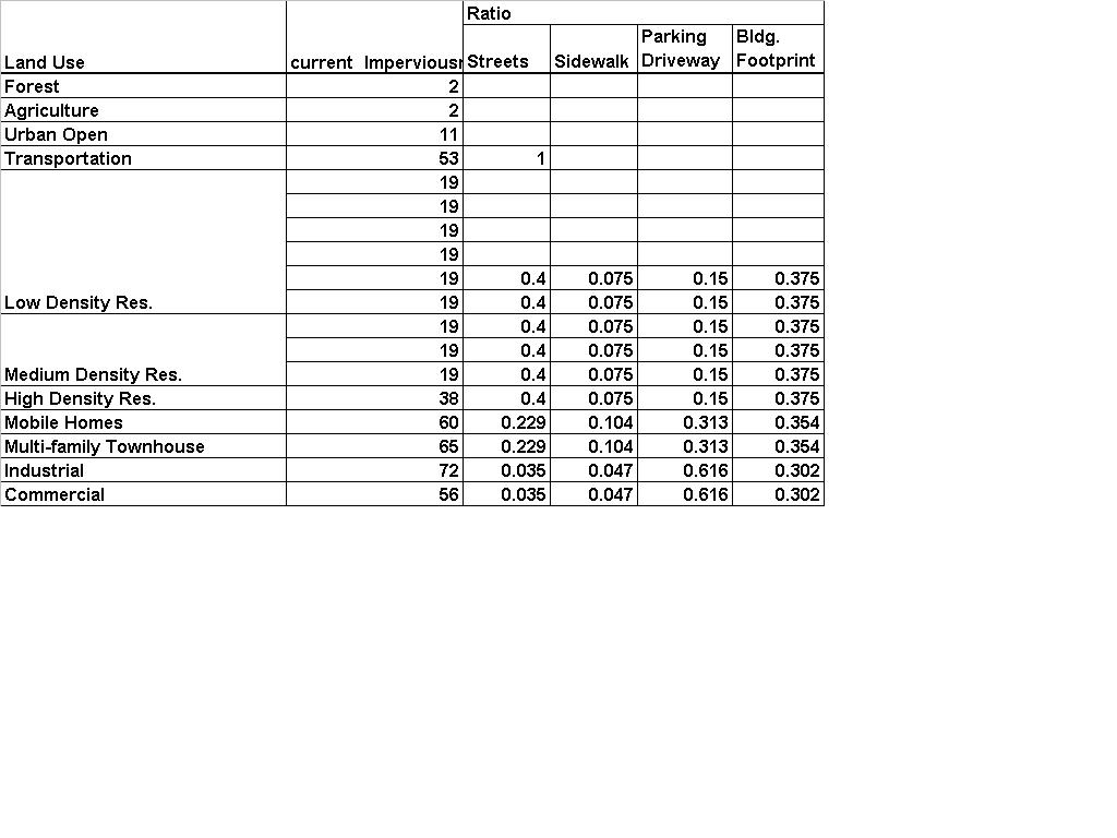
Land-Use / Imperviousness conversion table

Road reductions
-
Based on research done by the American Society of Civil Engineers.
-
Reduced road widths by aprrox. 1/3 (essentially 32 ft wide
to 22 ft wide).
-
Didn't change the widths in "built" areas.
-
Changed 80% of the widths in "unbuilt" areas as 20% are considered
built.
Outlook of Imperviousness: Superior Township
calculations based on zoning map
Outlook of Imperviousness: Scio Township
calculations based on zoning map
Implications
-
Graphically represents the kinds of pressures their watersheds
may expect to see
-
Shows what they could expect to see with typical road reductions
-
Indicates that road reductions may not be the only answer
may want to look at creative more solutions
cluster development
shared driveways
retrofits / curb - cuts
stream buffers -etc.
Drawbacks
-
Imperviousness based on land use can be highly variable -
not standardized
-
Looking at the issue from a single perspective
-
More studies need to be done in different regions (many studies
done out west)
See Phase Two - Measured
Study