Triangulated
Irregular Network
Ann
Arbor, Michigan
City of
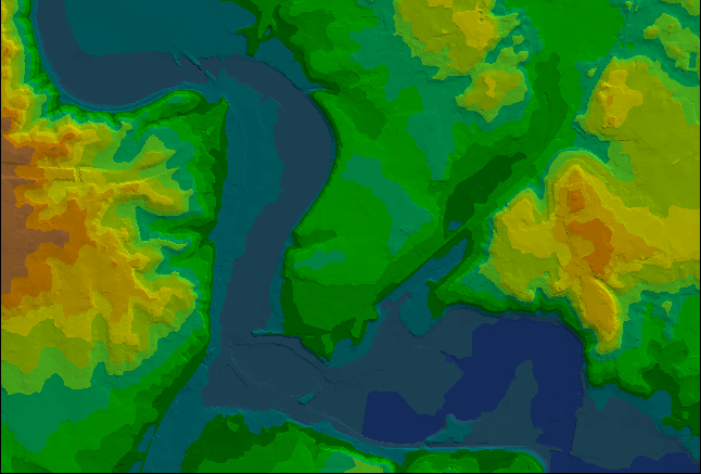
Ann Arbor contour map, with contours at a five foot interval, is used to
create a triangulated irregular network in ArcView GIS, 3.2, Spatial Analyst
Extension. Steep slopes can be readily visualized and creeks and
swales become evident. When this sort of spatial analytic tool is
used in conjunction with other existing maps, guidelines for policy of
where to develop and not to develop may emerge. Base maps from City
of Ann Arbor (thanks to Merle Johnson). Legend is measured in feet
above mean sea level. The interval in the legend is five feet.
The TIN was calculated from the five foot interval creating 45 separate
layers in which to perform calculations. The GIS software, in selecting
a default color ramp, did not select 45 colors to show change in grade.
It grouped the data into subgroups of 15 to 20 feet by color. Thus,
each individual color represents 15 or 20 feet of elevation, ranging from
deep blue at 750+ feet to rust color at 975 feet. In particular,
-
750 to
800 feet: deeper blue to lighter blue, respectively;
-
800 to
850 feet: deeper green to lighter green, respectively;
-
850 to
900 feet: blue-green to chartreuse, respectively;
-
900 to
950 feet: yellow to orange, respectively
-
over 950
feet, rust.
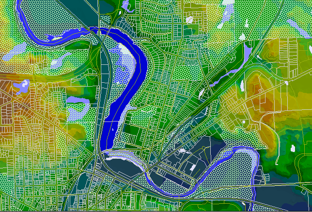
In the
map below, the parcel map is overlain on the TIN as are layers for parks
(stippled green), for water (blue), for street centerlines (green lines),
and for dams (magenta). Allen Creek enters the river just south of
the dam (north is at the top of the map)
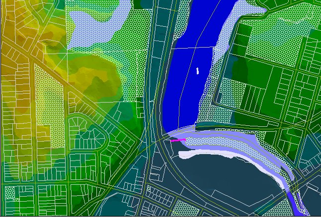
A closer
look allows more of the TIN to show through.
|